In antiquity, Sri Lanka was known to travellers by a variety of names; in India as Lanka or Sinhala, ancient Greek geographers called it Taprobane and Arabs referred to it as Serendib (the origin of the word “serendipity”) Ceilão, the name given to Sri Lanka by the Portuguese when they arrived in 1505, Then it was transliterated into English as Ceylon. As a British crown colony, the island was known as Ceylon. It achieved independence as the Dominion of Ceylon in 1948 Geographically It is in the Indian Ocean southwest of the Bay of Bengal, between latitudes 5°and 10°N, and longitudes 79° and 82°E. Sri Lanka is separated from the Indian subcontinent by the Gulf of Mannar and Palk Strait.
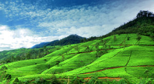
Tea factory and Tea Plantation
Our villa is located in close proximity to a tea factory and our guests can visit the factory, the distance is about 700m from the villa and can purchase fresh tea from the factory shop as well. Opportunity to try out tea plucking is possible too.
Pine forest trek
Sri Baktha Hanuman Temple – Ramboda
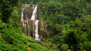
Ramboda water fall
Nuwaraeliya
Horton Plains
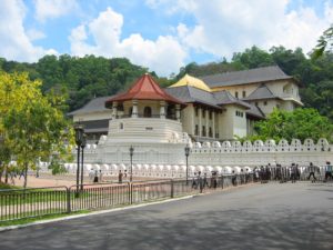
Kandy